 Summary
 Summary
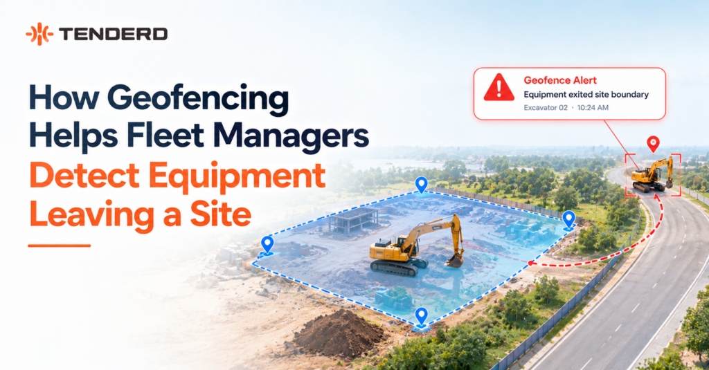
Geofencing draws a virtual boundary around a site, yard, or restricted zone and logs the exact moment a machine crosses it. On TENDERD, every crossing is recorded as a Geo In or Geo Out event, timestamped and tied to the specific machine, so a fleet manager knows the instant equipment leaves a site rather than discovering it missing at the next equipment count.
Key Takeaways
- Geofence exits are logged automatically, not discovered manually. Every Geo Out event is timestamped and attached to the exact machine, replacing the phone call and the physical headcount.
- Not every exit is a problem, and the alert alone doesn’t say which one is. An after-hours exit or a departure from a restricted zone carries more weight than a scheduled transport between sites.
- On multi-subcontractor sites, geofencing settles disputes rather than starting them. Entry and exit timestamps give every party the same record of which machine left, and when.
- Geofencing is not an isolated alert. It feeds directly into fuel theft detection and automatic trip creation, so the same boundary data does more than one job.
Introduction
A crane that was on site yesterday isn’t there this morning, and the first question anyone asks is when it left. On most sites, the honest answer is nobody knows. Equipment moves between yards, sites, and subcontractors constantly, and without a system watching the boundary, the only way to catch a departure is to notice it’s gone.
Geofencing closes that gap by turning a site’s physical perimeter into a digital one that a fleet management platform can watch continuously. This article explains how that detection actually works, what a fleet manager sees when a machine crosses a boundary, and where geofencing fits into the wider picture of equipment security, billing, and multi-contractor site coordination.
What is Geofencing in Fleet and Equipment Management?
A geofence is a virtual boundary drawn around a real-world location, a project site, a yard, a camp, or a restricted zone, using GPS coordinates rather than a physical fence. Once a piece of equipment carrying a GPS tracking unit crosses that boundary, the system logs the event automatically.
On TENDERD’s Track module, geofences are managed at the group level through a list-and-map view. A fleet or site manager draws the boundary directly on the map, or imports one from a KML file, and it appears in a running list alongside every other geofence for that group. Selecting any geofence highlights its exact polygon on the map, so the boundary being monitored is never a guess.
Some geofences carry a Restricted Zone classification, shown as a badge next to the name. This marks a boundary that calls for stricter attention than an ordinary site or camp perimeter, such as a high-value equipment yard or a zone that should see very limited equipment traffic.
How Geofencing Detects Equipment Leaving a Site
The mechanism itself is straightforward. Every tracked machine transmits its GPS position on an ongoing basis. The platform compares that position against every geofence boundary the machine is near. The moment the position crosses from inside a boundary to outside it, the system logs a Geo Out event. The reverse crossing logs a Geo In event.
Each machine has its own Geofence events setting, a toggle in its violation settings panel that turns this logging on or off for that specific asset. Once enabled, every crossing is recorded in a dense, timestamped Entered and Exited log against every geofence the machine has passed through, viewable from that machine’s own record.
This is a live, working capability. Geo In and Geo Out events are logged and reported on the Track dashboard for every machine with the setting enabled, giving a fleet manager an exact record of every site the machine entered or left and when.
Geofencing also connects into how unsafe or unusual driving is evaluated. A speed violation that would be flagged as ordinary overspeeding elsewhere on a route can be escalated when it happens outside a geofence altogether, since a machine moving quickly with no registered boundary nearby is a different situation than one exceeding a limit inside a known site.
Why This Matters for Fleet and Equipment Managers
A geofence exit is a small piece of data, but it answers questions that otherwise cost a lot of time and trust to resolve.
Take a machine that leaves a site at two in the morning. Without geofencing, that departure is invisible until someone notices the equipment missing, possibly the next morning, possibly days later. With geofencing, the Geo Out event is logged the moment it happens, timestamped and attached to the machine, giving a fleet manager the starting point of an investigation instead of a guess about when it began.
The same log settles a different kind of problem: a billing dispute over how many days a piece of equipment actually spent on site. When a client or subcontractor questions an invoice, the entry and exit timestamps for that machine’s geofence history are the record, not a memory of when the crew mobilized or demobilized.
Key Benefits and Applications
Geofencing on its own is one data point. Combined with the rest of a fleet management platform, it supports several distinct use cases.
- Flagging unauthorized movement. A Geo Out event outside scheduled hours, or from a Restricted Zone, is the kind of exit worth a phone call rather than a routine log entry.
- Strengthening theft and fuel-loss investigations. In TENDERD’s Fuel module, a fuel drop that happens while a machine is stationary, idling, and outside its registered geofence is treated as a higher-confidence signal of unauthorized fuel siphoning than any one of those factors alone. Geofence status is one input into that pattern, not the only one.
- Settling billing and subcontractor accountability disputes. Entry and exit timestamps give every party on a shared site the same record of which machine was where, and for how long.
- Removing manual paperwork from logistics. In the Logistics module, trip configurations are built directly on top of Track geofences, so a pickup and delivery sequence generates a structured trip history automatically instead of relying on someone to log it by hand.
Geofencing on Multi-Subcontractor Construction Sites
A single-owner yard with one gate is a relatively simple case. A large construction or energy site with a dozen subcontractors, each bringing their own machines through the same access points, is a different problem entirely. Nobody watching that gate can reliably tell which excavator belongs to which contractor, or confirm it left when it was supposed to.
Geofencing removes ownership from the question. The boundary is defined once, at the site level, and every registered machine that crosses it is logged the same way regardless of which subcontractor operates it. On a project with TENDERD covering 130 assets across 17 subcontractors for ALEC’s Abu Dhabi SeaWorld development, that kind of shared visibility across a mixed, multi-contractor fleet contributed to a 25 percent improvement in equipment utilization and a 34 percent reduction in equipment downtime, outcomes that depend on everyone working from the same record of where equipment is and when it moved.
Challenges and Limitations
Geofencing is dependable, but it isn’t automatic in the sense of requiring no upkeep.
- Boundary accuracy depends on how the geofence was drawn. A polygon that doesn’t match the real site edge generates false exit alerts, or misses genuine ones, and either failure erodes trust in the system quickly.
- Connectivity gaps happen at exactly the sites where geofencing matters most. Remote construction sites, ports, and desert operations can have patchy cellular coverage, so a crossing event sometimes arrives in a batch rather than the instant it happened.
- An exit alert alone doesn’t say why the machine left. A scheduled transport to another site and an unauthorized departure produce the same Geo Out event. Telling them apart depends on context, the time of day, whether the move was scheduled, and what the machine’s speed and status were doing at the time.
- Some geofence-based alerting is still rolling out. Geo In and Geo Out logging is live today. A more granular alert specifically for entry into or exit from a Restricted Zone is on TENDERD’s roadmap and not yet available, so a Restricted Zone currently functions as a classification a fleet manager can see and prioritize, rather than a separate automated alert in itself.
Best Practices for Setting Up Geofencing
- Draw boundaries deliberately, and revisit them. Site edges change as work progresses, and a geofence set up on day one of a project may no longer match the site by month six.
- Turn on Geofence events for every machine that matters, not a sample. A fleet where half the equipment is monitored and half isn’t creates a blind spot on exactly the assets nobody happened to enable.
- Reserve the Restricted Zone classification for boundaries that genuinely warrant extra attention. A high-value equipment yard or a no-go area is a better fit than marking every geofence as restricted, which dilutes the classification’s usefulness.
- Cross-reference an exit with time and status before escalating it. A departure at 2 a.m. from a machine that was already idling reads very differently from the same exit during a scheduled shift change.
The Final Thought
A site boundary that nobody is watching is only a boundary on paper. Geofencing turns it into a record, logging the exact moment equipment leaves, whether that departure needs a second look, and giving every subcontractor on a shared site the same account of what happened and when.
If your team is still relying on a headcount or a phone call to know whether equipment is where it should be, it’s worth seeing how live Geo In and Geo Out tracking works on your own fleet.
Book a demo of TENDERD Track to see geofence-based detection, Restricted Zone classification, and automatic trip creation running on your own sites.
Related TENDERD Articles
Explore more insights from TENDERD on fleet management, equipment optimization, safety, productivity, and smarter fleet operations.
- How GPS Fleet Tracking Works and What It Can Tell Fleet Managers
- What Happens When Fleet Safety Alerts Go Unanswered
- Fleet Management vs Fleet Telematics: What’s the Difference?
Recommended TENDERD Solution: Track module
Frequently Asked Questions
What happens when equipment leaves a geofenced site?
The system logs a Geo Out event the moment the machine's GPS position crosses the boundary, timestamped and tied to that specific machine. The event appears in the machine's Geofence log alongside every other site it has entered or exited.
Can geofencing stop equipment theft?
Geofencing detects and alerts on unauthorized movement, it doesn't physically prevent a machine from being taken. It's strongest as part of a pattern: a geofence exit combined with an unusual time, an idling engine, or a fuel-level drop is a much stronger signal than a geofence crossing on its own.
How accurate is geofence detection for heavy equipment?
Accuracy depends mainly on two things: how precisely the boundary was drawn against the real site, and how reliable GPS and cellular connectivity are at that location. A geofence that hasn't been reviewed since the site's early layout is a common source of false alerts.
What is the difference between a geofence and a Restricted Zone?
A geofence is any drawn boundary, a site, a yard, a camp. A Restricted Zone is a specific classification applied to a geofence that warrants stricter attention, such as a high-value storage yard. Geo In and Geo Out logging works the same way for both today; a dedicated automated alert specifically for Restricted Zone entry and exit is on the roadmap rather than live.
Does geofencing work across multiple subcontractors sharing one site?
Yes. The boundary is defined once at the site or group level and applies to every registered machine that crosses it, independent of which subcontractor owns or operates that equipment.