 Summary
 Summary
GPS fleet tracking combines satellite positioning, an onboard device connected to the vehicle or machine, and cellular connectivity to send location and status data to a cloud platform in real time. Beyond a pin on a map, it can tell a fleet manager a machine’s speed, ignition status, fuel level, running hours, engine diagnostics, who is operating it, and whether it has entered or exited a defined site or restricted zone.
Key Takeaways
- GPS fleet tracking is more than a location dot. It combines satellite positioning, an onboard device, and cellular data transmission to build a live and historical record of where a machine is, what state it’s in, and how it’s being used.
- What it can tell a fleet manager goes well beyond “where.” Speed, ignition state, engine diagnostics, fuel level, hourmeter and odometer readings, and geofence entries and exits are all part of the same feed.
- In a mixed fleet, tracking data only becomes useful once it’s organized machine by machine. A shared map with pins on it isn’t the same as a per-machine record with its own history, diagnostics, and violation log.
- Fleets that connect tracking data to a full platform report measurable outcomes. AD Ports achieved a 30 percent improvement in equipment utilization and a 24 percent decrease in idling time after moving from fragmented tracking to a connected platform.
Introduction
Ask a fleet manager what their GPS tracking system tells them, and the answer is usually some version of “where my vehicles are.” That’s true, but it undersells what a properly configured tracking system actually captures. A single tracked machine can report its location, speed, ignition state, fuel level, running hours, and whether it just crossed into a restricted area, all in the same data feed that used to be reduced to a blinking dot on a map.
That gap between what GPS tracking can report and what most fleets actually use it for has a real cost. Aramco Mobility, managing a fleet of 15,000 mixed assets across Saudi Arabia, ran into this directly: the challenge was never really a lack of GPS-equipped machines, it was that location data wasn’t connected to real-time visibility teams could act on, which meant delayed manual reporting instead of a live operational picture.
This article breaks down how GPS fleet tracking actually works, mechanically, and then goes through what a fleet manager can realistically expect it to tell them, from a live location down to engine diagnostics and per-machine violation history. It also covers where the friction shows up when tracking data isn’t organized well, and how GPS tracking fits inside a broader UAE and GCC fleet operation running a mix of vehicles and heavy equipment.
What Is GPS Fleet Tracking?
GPS fleet tracking is the use of GPS-enabled hardware, onboard sensors, and wireless connectivity to determine a vehicle or machine’s location and operating status, and transmit that information to a central platform where it can be viewed and reviewed. At its simplest, it answers three questions: where is this asset right now, where has it been, and what is its current state, such as running, idle, or switched off.
In TENDERD’s platform, this function lives in the Track module, which acts as the fleet’s location and asset-visibility layer. It also functions as the fleet’s master asset record: the one place holding a machine’s identity (brand, model, registration, custom ID), live telemetry, diagnostic signals, documents, and violation and geofence history, alongside the operators enrolled to run those machines.
How Does GPS Fleet Tracking Work?
Mechanically, GPS fleet tracking relies on three layers working together.
A GPS receiver, either wired into a vehicle’s OBD port or hardwired into a piece of equipment, calculates its position by measuring the time it takes for signals from multiple GPS satellites to reach it, a method called trilateration. That gives the device its coordinates.
The device also reads directly from the machine itself. On a vehicle, that typically means pulling data off the CAN bus, the vehicle’s internal diagnostic network, for signals like ignition status, battery charging state, and whether a key is in the ignition lock. On heavy equipment, similar sensors report engine hours, fuel level, and operating status.
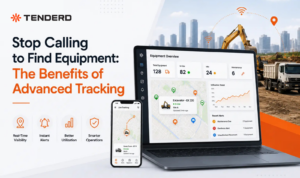
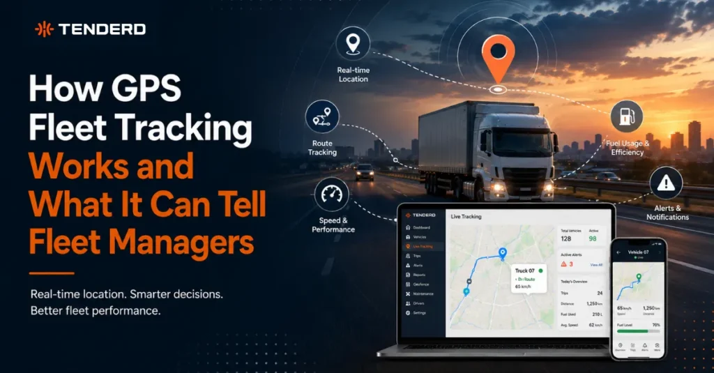
That combined data, position plus machine status, is transmitted over a cellular network to a cloud platform, where it becomes available in something close to real time. In TENDERD’s Track module, this shows up as a live map with every machine in a group represented as a color-coded pin, so a fleet manager can see at a glance which machines are working, idle, switched off, or offline, without opening a single individual record. Clicking a pin surfaces a location and summary directly on the map, and opening the full machine record shows the deeper telemetry underneath it.
None of this depends on someone manually checking in. Once a device is installed and a geofence or two is drawn, the system logs entries, exits, and status changes on its own.
Why Is GPS Fleet Tracking Important?
The value of GPS fleet tracking isn’t the tracking itself, it’s what stops happening once you have it. Fleet managers no longer need to call a driver or site supervisor to confirm a machine’s location, or wait for an end-of-day report to find out a piece of equipment sat idle for six hours. That data exists the moment it happens.
This matters more as a fleet gets larger and more spread out. A company running a handful of vehicles on a fixed route can often get by without granular tracking. A company running trucks, cranes, generators, and compressors across multiple project sites, with some assets owned, some rented, and some supplied by subcontractors, cannot realistically manage that by phone call and spreadsheet. Aramco Mobility’s experience managing 15,000 mixed assets across Saudi Arabia is a clear example: the operational challenge wasn’t a lack of GPS-equipped machines, it was that visibility into equipment allocation and site operations depended on delayed manual reporting rather than a live feed, which made it difficult to catch inefficiencies before they compounded.
GPS tracking data is also what everything else in a fleet management platform is built on. Fuel monitoring, maintenance scheduling, safety scoring, and productivity reporting all depend on accurate location and machine-status data as their starting point. Get that foundation wrong, through poor device coverage or badly configured geofences, and every capability built on top of it inherits the same gaps.
What GPS Fleet Tracking Can Actually Tell a Fleet Manager
Where a machine is, right now and historically. Beyond a live position, Track keeps a full History for each machine: a date range picker showing distance covered, ignition-on time, and top speed for that period, plotted on a map of historical position points.
What state a machine is in, beyond just moving or stopped. The Location tab reports live ignition status, speed, heading, altitude, satellite count, and a last-updated timestamp, so a status reading isn’t stale by the time someone looks at it.
Engine and vehicle diagnostics most tracking systems don’t surface. Two collapsible diagnostic panels pull data straight from the machine: CAN bus signals like battery charging state, whether a charging cable is connected, and whether a key is currently in the ignition lock, plus a broader set of door and security signals, including whether doors, the engine cover, or the trunk are open or closed.
Usage data tied to maintenance and fuel, not just location. Odometer and hourmeter readings sit alongside live GPS telemetry, and fuel level is reported in the same view, giving a fleet manager the usage inputs that maintenance schedules and fuel tracking are actually built on.
Who is operating the machine, automatically. An operator’s RFID or iButton key links them to a specific machine, so trip and violation data is tied to a person, not just a vehicle ID. Where no operator is currently linked via RFID, that field is shown locked rather than guessed at.
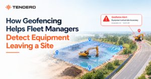
Every entry and exit from a defined area. Geofences mark project sites, camps, parking areas, and restricted zones, and a Geofence Timeline logs every time a machine crosses one, viewable by status, by geofence, or by operator, with quick range controls for yesterday, the last 7 days, the last 30 days, or a custom range.
Safety-relevant events, logged at the machine level. Overspeeding, harsh acceleration, and harsh braking are counted and logged in a detailed table showing date, time, geofence, event, operator, and location, using the same violation vocabulary the Safety module uses, scoped here to an individual machine’s record.
None of this requires a fleet manager to dig for it. It’s what a properly built tracking system reports as a matter of course. The difference is whether that data reaches a screen someone actually looks at, in a form they can act on.
GPS Fleet Tracking in the UAE and GCC
UAE fleets rarely consist of a single asset type running a single route. Construction and infrastructure projects run trucks alongside cranes and generators. Ports and logistics hubs move equipment between owned, rented, and subcontractor-supplied machines. Oil and gas and mining operations run assets across remote sites where a phone call isn’t a reliable way to confirm a machine is where it should be.
In that environment, GPS tracking earns its value by covering the whole mix, not just the vehicles. A tracked pickup truck and a tracked crane need the same baseline: an accurate location, a usage history, and a geofence record, regardless of who owns the machine or which OEM built it.
At AD Ports, deploying real-time tracking, maintenance, and reporting across equipment led to a 30 percent improvement in equipment utilization and a 24 percent decrease in idling time, alongside roughly 1,040 man-hours saved annually on manual data collection. On a construction program with ALEC, connecting visibility to proactive equipment management produced a 25 percent improvement in equipment utilization and a 34 percent reduction in equipment downtime, with shared visibility that helped keep subcontractor coordination on schedule. Both results depended on tracking data reaching people who could act on it, not just being collected.
Challenges and Limitations
GPS fleet tracking is not without friction, and it’s worth being direct about where it shows up.
Device coverage has to be complete, not partial. A fleet where half the machines are tracked and half aren’t produces a partial picture that’s often worse than no tracking at all, since it creates false confidence about the assets nobody is watching.
Geofences only work if they’re drawn accurately. A poorly drawn site boundary generates false entry and exit alerts, or misses real ones, which erodes trust in the whole system faster than almost anything else.
Cellular connectivity gaps happen at exactly the sites where visibility matters most. Remote construction sites, ports, and desert or offshore operations can have patchy coverage, which means data sometimes arrives in batches rather than truly live.
Violation thresholds need to match the asset, not a generic default. An overspeeding threshold set for a pickup truck doesn’t make sense applied to a crane, and thresholds that are too sensitive create alert fatigue that leads teams to ignore the system altogether.
Data alone doesn’t change behavior. A live map and a violation log are only useful once someone is assigned to review them and act on what they show. Tracking without a workflow behind it stays a dashboard nobody opens.
Best Practices for Getting Value from GPS Fleet Tracking
Cover the whole fleet, not just the easy assets. Vehicles are simpler to instrument than heavy equipment, but a mixed fleet with visibility gaps on the equipment side is still operating with a blind spot.
Set violation thresholds per asset type. Overspeeding, idling, and harsh driving thresholds should reflect what’s actually normal for that machine and that shift, not a single default copied across every asset in the fleet.
Draw geofences deliberately, and revisit them. Site boundaries, camps, and restricted zones should be checked periodically, especially on projects where the physical site changes as work progresses.
Link operators through RFID or iButton where possible, rather than assuming a machine and an operator are always paired the same way. Fleet assignments change, and automatic identification keeps violation and trip data accurate as they do.
Treat tracking as the foundation, not the finish line. Location and machine-status data is the input that fuel monitoring, maintenance scheduling, and safety scoring are built on. Getting it right first is what makes everything layered on top of it trustworthy.
What Basic GPS Tracking Shows vs. a Full Asset Record
| Data | Basic GPS Tracker | A Full Asset Record (TENDERD Track) |
|---|---|---|
| Location | Live pin on a map | Live pin plus full address, historical playback, distance covered |
| Status | Moving, idle, or stopped | Ignition, speed, heading, altitude, satellite count, last-updated timestamp |
| Diagnostics | Rarely available | CAN bus signals (charging state, immobilizer, key-in-ignition), battery voltage, door and security signals |
| Usage | Odometer only, if that | Odometer, hourmeter, and fuel level in the same view |
| Operator identity | Not linked to the machine | Automatic identification via RFID or iButton |
| Site boundaries | Basic geofence alert, if configured | Geofences plus a Restricted Zone classification and a full entered/exited timeline |
| Safety events | Raw alert, if any | Overspeeding, harsh acceleration, and harsh braking counted and logged against date, time, geofence, operator, and location |
| Asset identity | Device ID | Full machine profile: brand, model, type, year, capacity, registration, documents, custom specifications |
The gap between the two columns is usually invisible until a fleet manager needs an answer the first column can’t provide, like which operator was running a specific crane during a violation, or how many hours a generator has actually logged against its service interval.
The Bottom Line
GPS fleet tracking is often reduced to a single idea: knowing where a vehicle is. In practice, a properly built system reports far more: live status, engine and diagnostic signals, usage hours, operator identity, and a full record of every site a machine has entered or left. The difference between a fleet that has this and one that doesn’t isn’t visibility for its own sake. It’s the ability to catch a problem, like an idle machine, an overdue service, or an unauthorized site visit, before it becomes an expensive one.
For UAE and GCC operations running a mix of vehicles and heavy equipment across multiple sites, that depth of tracking is the foundation everything else gets built on. If your current tracking stops at a pin on a map, it may be worth seeing what a full asset record looks like on your own fleet. Book a demo of TENDERD to see live tracking, diagnostics, and geofence history working together on your fleet’s actual data.
Frequently Asked Questions
How accurate is GPS fleet tracking?
Accuracy depends on the device, the number of satellites in view, and signal conditions, but modern GPS fleet tracking is generally accurate to within a few meters, with position updates refreshing every 30 seconds to a couple of minutes depending on configuration.
Does GPS fleet tracking work on heavy equipment, not just vehicles?
Yes. The same core mechanism, a positioning device combined with onboard sensors and cellular transmission, applies to cranes, generators, compressors, and other heavy equipment, though the specific diagnostic signals available depend on the machine type.
Is GPS tracking the same thing as telematics?
Telematics is the broader term for the technology that captures and transmits vehicle and machine data, and GPS tracking is a core part of it.
Can GPS tracking identify who was operating a machine, not just where it was?
Yes, when the machine is set up with RFID or iButton operator identification. Without that link, tracking data shows the machine's activity but not necessarily who was behind it at a given moment.
What happens when a machine crosses into a restricted zone?
The system logs the entry and exit against that machine's geofence history, giving HSE and security teams a record to review. Restricted zones are configured separately from standard site or camp geofences to flag areas that need closer attention.
Is GPS tracking enough on its own, or do I need fleet management software too?
GPS tracking answers where a machine is and what state it's in. On its own, it doesn't evaluate whether that's good or bad, schedule maintenance, or flag unsafe driving patterns. That requires fleet management built on top of the tracking data.